Maps of Knowland Park are hard to find; the city of Oakland Parks and Recreation Department does not offer any. We understand the Bay Area Orienteering Club has some for sale. However, satellite images and maps can be found at maps.google.com, and some low- resolution topographic maps can be found on the City’s geographic information system. We have collected a number of these images, below.
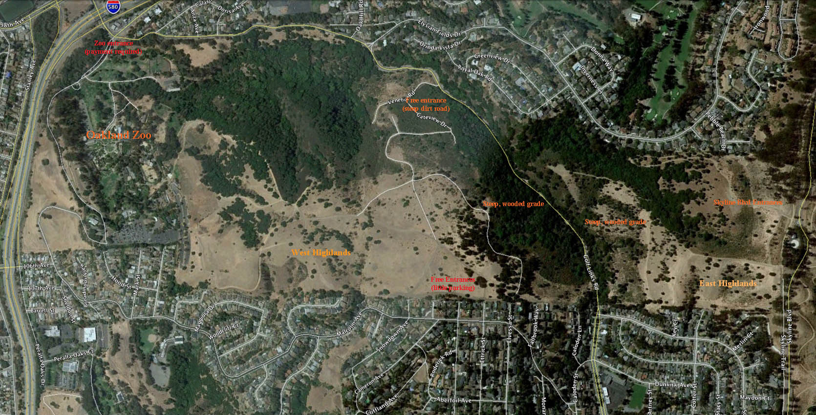
Knowland Park and surrounding neighborhoods; major local features are identified:

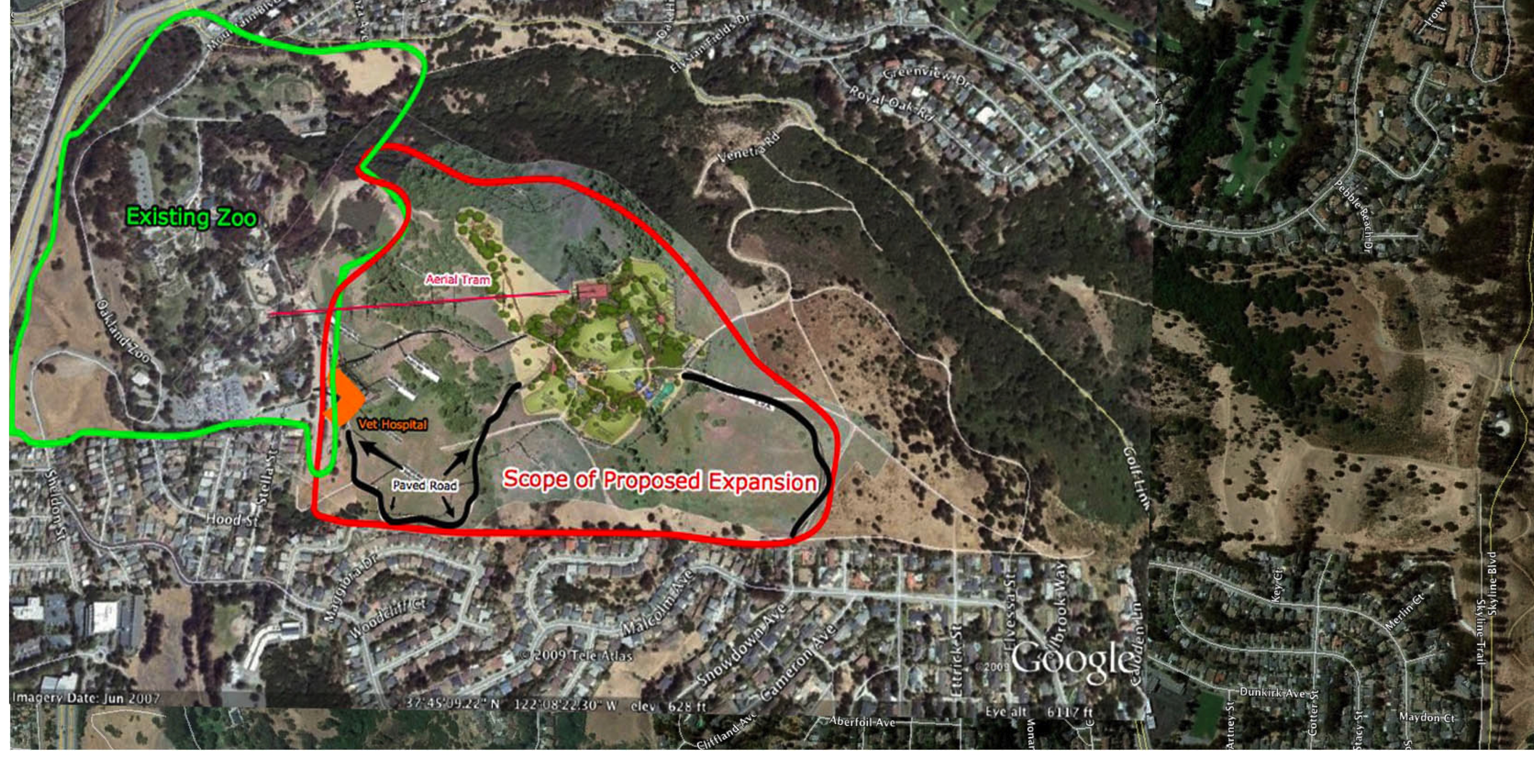
Knowland Park with expansion area superimposed; area of impact of proposed expansion is highlighted:

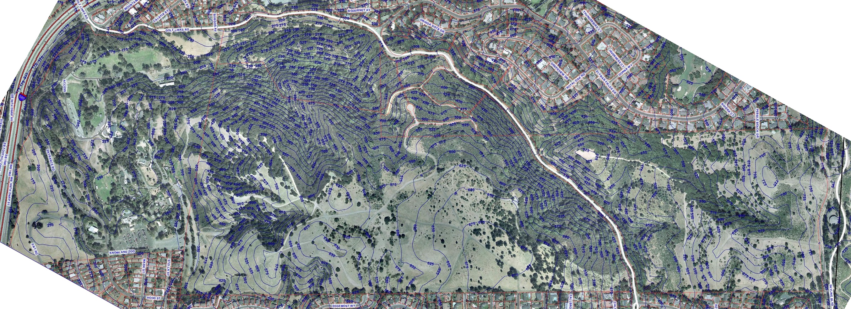
JPEG contour map, from City of Oakland resources:

JPEG contour photo, from City of Oakland resources:

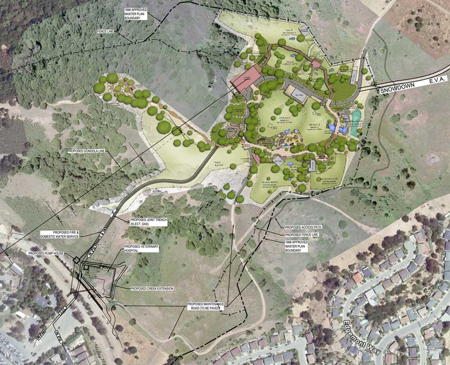
PDF document of (rotated) view of map overlaid with planned expansion:

Map of 2009 Bay Area Orienteering Event:

2009 Bay Area Orienteering Map with Zoo Expansion Overlay:

2009 Bay Area Orienteering Map with Zoo Road Overlay:

Detailed drawing of planned California exhibit:

Drawing showing current and planned Zoo facilities:

 Follow
