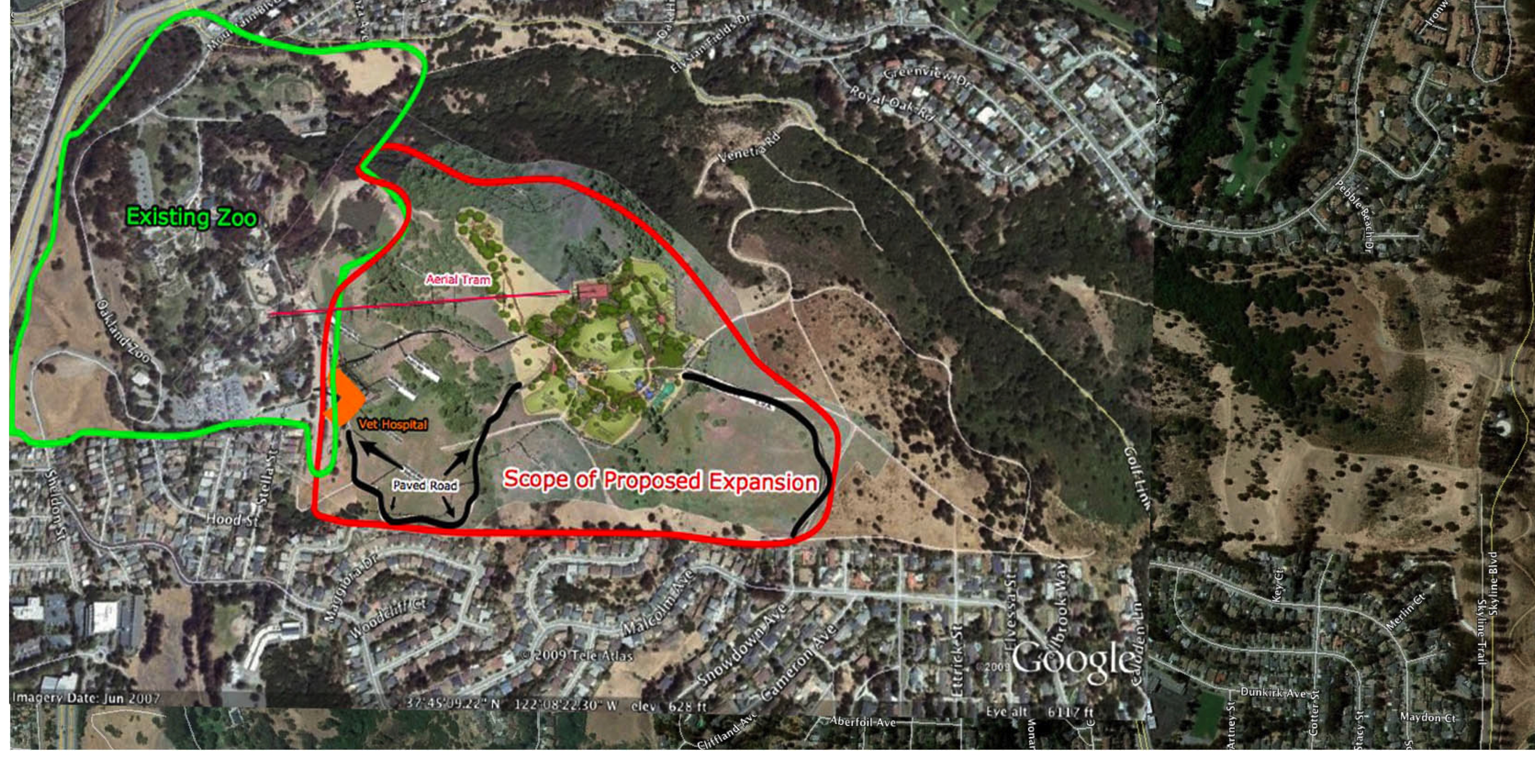
 Knowland Park with expansion area superimposed; area of impact of proposed expansion is highlighted:
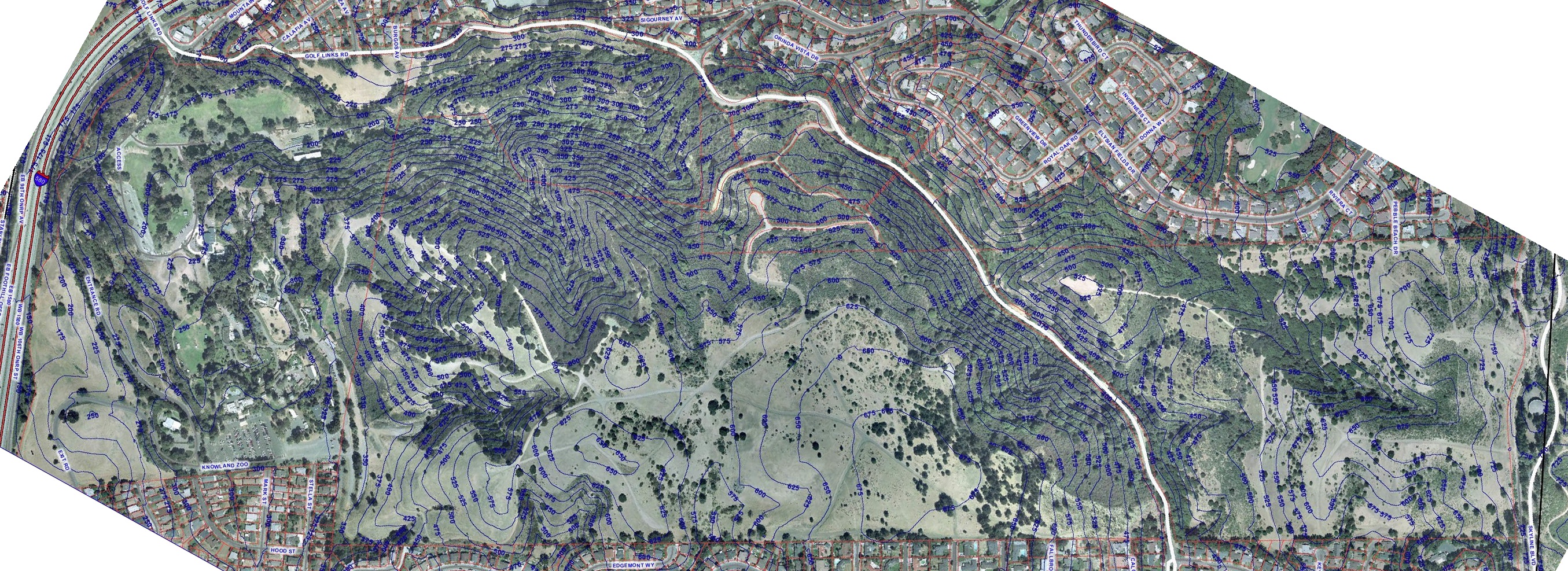
 JPEG contour map, from City of Oakland resources:
 JPEG contour photo, from City of Oakland resources:
 PDF document of (rotated) view of map overlaid with planned expansion:
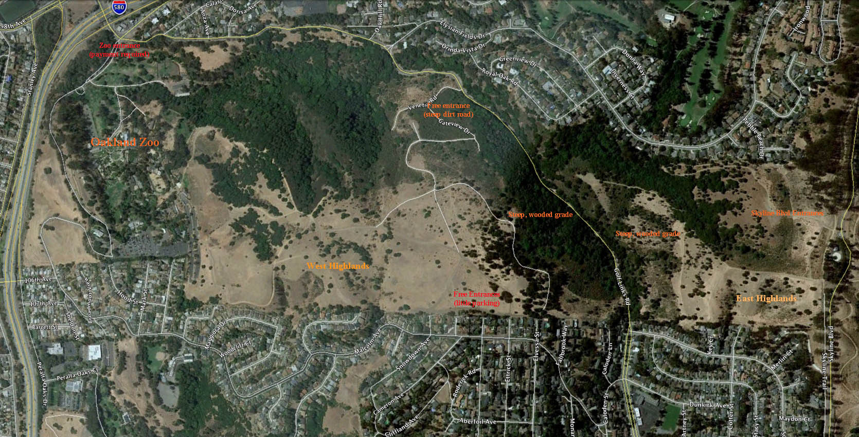
 Map of 2009 Bay Area Orienteering Event:
 2009 Bay Area Orienteering Map with Zoo Expansion Overlay:
 2009 Bay Area Orienteering Map with Zoo Road Overlay:
 Detailed drawing of planned California exhibit:
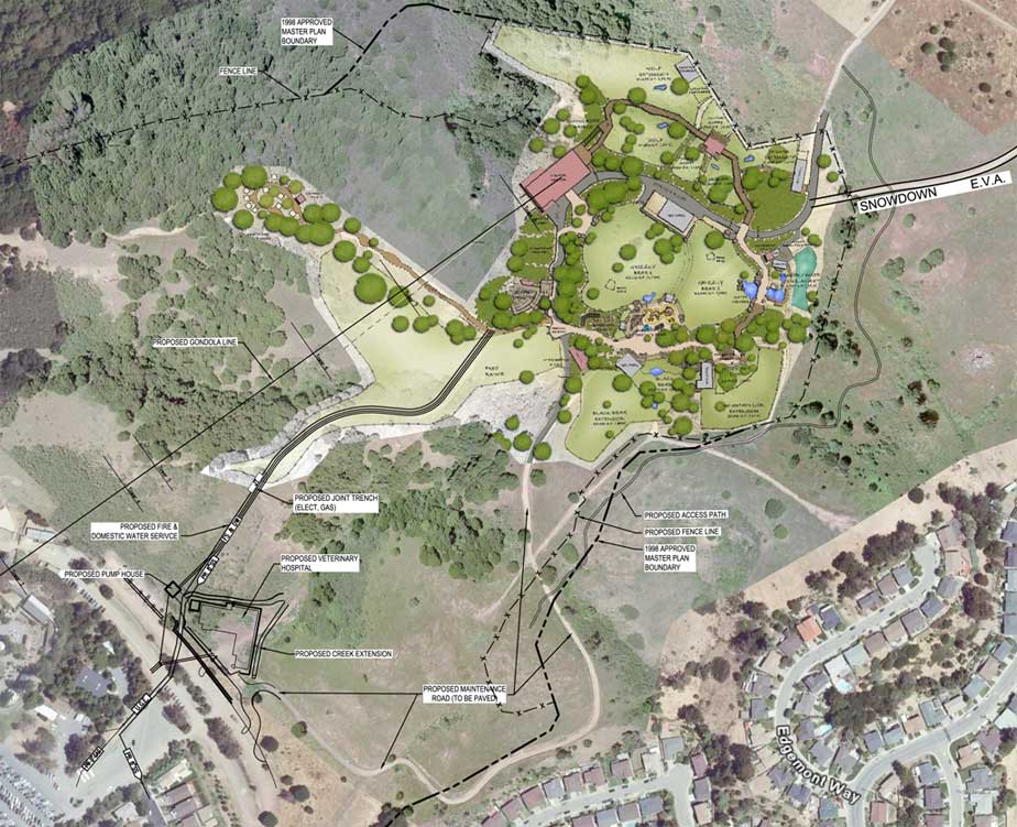
 Drawing showing current and planned Zoo facilities:

 Follow
